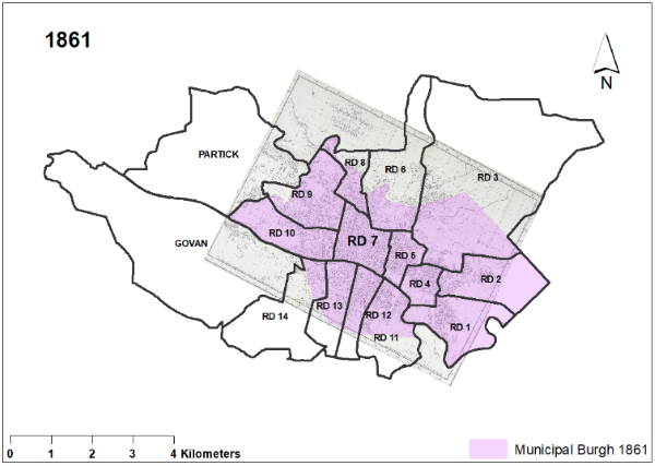
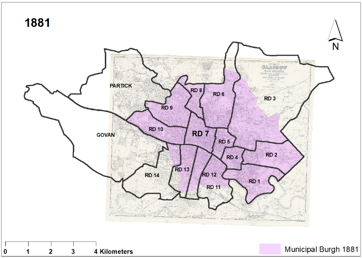
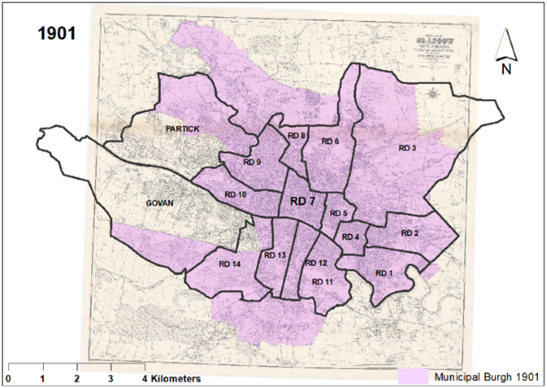
Urban ExpansionDefining Glasgow

Population Growth

Accelerating economic growth and population increase in the later nineteenth century caused unprecedented demand for more space. The population of Glasgow Municipal Burgh grew from about 400,000 in 1861 to 550,000 in 1881 and more than 750,0000 by 1901.

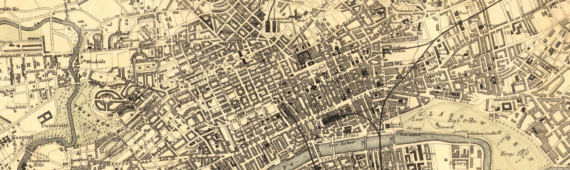
High density tenement buildings allowed large numbers of people to live and conduct business in close proximity in the city centre. The physical extent of Glasgow also expanded to accommodate new suburban development.

But the Burgh boundary did not yet include the most rapidly expanding suburbs. Notably it excluded Govan and Partick, the centres of shipbuilding and heavy industry. These suburbs were growing even faster than the city centre as shown by the graph below. 


line graph showing population increase in Glasgow and each of its suburbs between 1861 and 1901

Population increase in Glasgow and suburbs between 1861 and 1901


Urban Extent

Municipal Burgh boundary changes in the nineteenth century did not keep pace with Glasgow’s population growth, but the Post Office Directory of Glasgow businesses included a detailed street plan. This was updated every year.

On fold-out pages, these maps grow physically larger over time. The changing area of map coverage demonstrates the onward march of Glasgow’s urban footprint into its previously rural hinterland.

The extent of change is easier to gauge if we superimpose our research project’s definitive outer limit of Glasgow on our three observation periods. This outer limit is composed of Glasgow Registration Districts for Glasgow City as they were defined in 1881, plus Govan and Partick.

Glasgow urban extent 1861-1901: PO Directory map, Burgh boundary, and superimposed 1881 RDs

Swan (1861) and Bartholomew (1882; 1901) maps for POD images reproduced with the permission of the National Library of Scotland